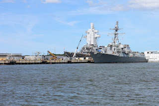
Since we are not boat people (Go Army, Beat Navy!) we took to the water via Norfolk's harbor tour on the American Rover.
I have often felt disappointed that Norfolk doesn't have a beautiful, touristy coastline but after touring the harbor I have a new appreciation of Norfolk's working coastline. As someone said recently, it has a unique beauty. Everywhere you look, other than the Waterside area in downtown, there are ship yards, ship repairs, shipping containers, docks, naval vessels, work boats, naval facilities ...
At the southern tip of West Ghent and just west of the Midtown Tunnel is an industrial area. Located in this area and a short walk from our house are a couple of our favorite restaurants, Tortilla West and Orapax.
In addition there is the Smartmouth Brewing Company one of two Norfolk breweries and The Birch Bar, rated one of the world's top 50 beer bars (according to ratebeer.com). Yes, I said WORLD.
But back to the water ...
We can walk past the Orapax Inn and past Tortilla West and at the southern end of Orapax Avenue (the northern end of Orapax Ave. ends at the intersection with our street) is a ship repair facility and there are two ships under repair right now (above).
Moving northwest along the coastline is a landmark you see when headed north across the Midtown Tunnel - cranes at the Lambert's Point Docks. The Lambert's Point Docks property encompasses 117 acres and is a part of the Norfolk Southern Corporation. Ships bring cargo here especially lumber and rubber.
Continuing northwest is a huge area where the rail yard for the Norfolk and Southern Railroad lies. This is the headquarters, right here in our neighborhood, of this mammoth company. NS operates over 20,000 miles of rail in 22 US States and in Canada. Their most commonly transported product is coal.
In the photo above see the two black structures? Those are the culmination of the rail lines where the cars filled with coal reach the ships that deliver the coal, to wherever. That is a ship (blue and red) behind the structure on the right.
The railroad tracks that enter this ginormous rail yard create the northern border of our neighborhood. You can see them on the map at the top, just above Blue Bird Park (really Jeff Robertson Park). And here, in this photo from the park, you can see the train cars in the background.
Love that caution sign.
So, that completes our tour. Our very abbreviated and highly summarized tour.
But, I still have questions. The most pressing is what did this area look like in say, 1910? Before the houses and apartments were built? I know that this was once a rural area with a farm, Cromwell Farm. But, how did it become a neighborhood? And why?
And I know that the US Navy didn't have a foothold here until 1917 right after we entered WWI. So, without the Navy how was the harbor different? Hmmmm. Hopefully, I will get some of those answers.
Stay tuned ...


No comments:
Post a Comment